 |
| Our tracks through Penobscot Bay showing the various towns and islands visited. |
Wednesday, September 1, 2010
Monday, August 30, 2010
Notes on Maine - Fog

| Foggy morning in Buckle Harbor, Swans Island. |
Wednesday, August 25, 2010
Notes on Maine - Lobster buoys
 |
| Buoys lining a path on Warren Island (just west of Isleboro Island) in Penobscot Bay. Park rangers and visitors collected these from the island shoreline over who knows what period of time. |
What took us by surprise was what we saw along the exposed, and not-so-exposed, shorelines. Buoys wedged under tree roots at the high-tide line; buoys in rock and boulder crevices; buoys lying on pebble beaches. It didn't take long--once we decided--to collect a fair number of these. In addition to having the frayed, cut end of a piece of polypropylene float line attached, many buoys had the spindles, buoy sticks and breakaway plastic swivels attached. (The swivels have a 600 or 1000 lb. test strength are meant to break if a marine mammal get entwined in the float line.)
Friday, August 20, 2010

Sunday, August 15, 2010

Tuesday, August 10, 2010

Thursday, August 5, 2010

Tuesday, August 3, 2010

Thursday, April 29, 2010
Aerial photos
I just received an email with an attachments of 10 sample photos from that helicopter outfit that buzzed us. Here's five of them cropped a bit.
 |
| We're steaming along at 12.5 knots northbound in the ICW near Grant; winds are 20 knots out of the NW. |
Sunday, March 14, 2010
Back in Satellite Beach
 |
| Dotted line path showing clockwise journey around Florida, and the locations where we stopped each evening. |
Saturday, March 13, 2010
Manatee Pocket
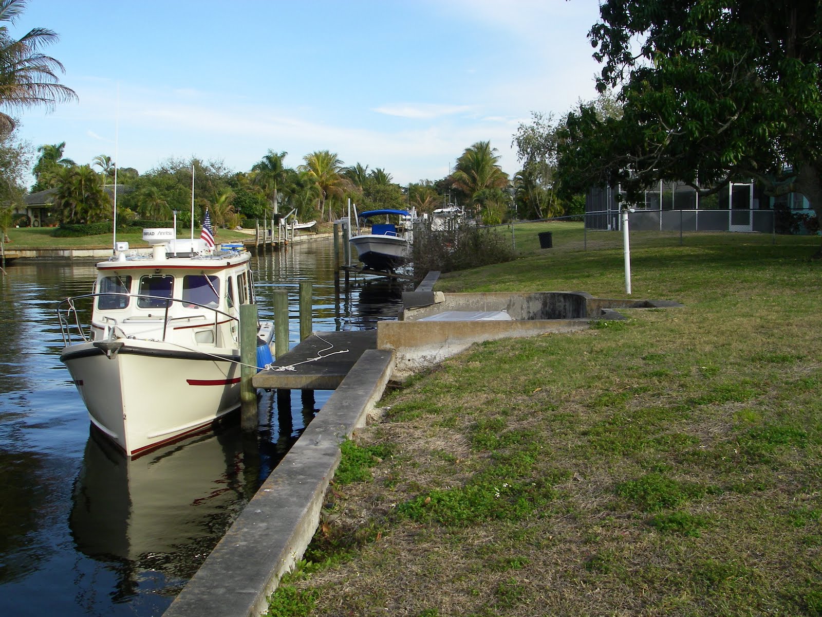
 |
| Under Yamaha 8 hp power from Indiantown to the St. Lucie Locks; give the little engine a bit of exercise and in fresh water too. |
Friday, March 12, 2010
Indiantown

Heavy and continuous rain today so we'll be staying put in Indiantown marina. Between rain showers we walked around the boat yard for the following photo 'essay'.
Thursday, March 11, 2010
Indiantown
 |
| Rim route with wind on the nose. |
Wednesday, March 10, 2010
Clewiston

Tuesday, March 9, 2010
La Belle
 |
| Left this morning from an old college friend's home in Fort Myers. |
Sunday, March 7, 2010
Cayo Costa
 |
| Motored over to Cayo Costa State Park docks this morning. |
Saturday, March 6, 2010
North Captiva Island
 |
| We saw 2 feet at the 'choke point' when entering--eye-ball navigation required because the GPS chartplotter(s) had me directly over the 3 foot marked location. On departure the next day Robert Sidney and Pecan sounded the way out for Polynya, we never saw under 3 feet (good thing for Polynya with their 3'10" draft!) |
Anchored in Fosters Bay off North Captivated Island next to fellow Rosborough owners Dave and Barbara on Robert Sidney. Met their fellow Canadian friends John and Lees on Polynya, a NorSea 27. NW around 10 to 15 knots, low 60s, sunny.Tamara is in heaven with the quantity, diversity and size of the shells on the gulf-side beach.
Friday, March 5, 2010
Fort Myers Beach
 |
| They were having a nice sail as we entered San Carlos Bay. |
Thursday, March 4, 2010
Brezzy Naples
 |
| We moved to the a City mooring ball after a day in the slip. |
Enjoying our time in Naples. A strong cold front has pushed thru and we've had several days of strong NW winds, now moderating to 18 knots. High is59F but sunny.
Sunday, February 28, 2010
Naples

Saturday, February 27, 2010
Marco Island

Friday, February 26, 2010
Goodland
 |
| Leaving Flamingo it's best to stay in the marked channel; mud flats exposed on the southeast side of Red 16. |
Thursday, February 25, 2010
Everglades National Park
 |
| You can see clearly the park boundary we followed inside of coming north from the Keys. |
 |
| Everglades National Park headquarters in Flamingo. |
Tuesday, February 23, 2010
Flamingo
 |
| Our track from Islamorada to Flamingo thru Florida Bay. |
Arrived in Flamingo at 2pm having left the fuel dock at PYH Marina at 8:20am.
Monday, February 22, 2010
Islamorada
Hanging out at Plantation Key Marina due windy,rainy weather. Good news is that its been in the mid 70s.
Sunday, February 21, 2010
Plantation Key
 |
| PYHarbor marina is located in the larger Founder's Park in Islamorada |
Saturday, February 20, 2010
Key Largo
Anchored in Key Largo Tarpon Basin at 1:58pm after 26 nm. Nice dinghy dock at a recently constructed Monroe county administrative office/park/cultural center site just south of Hampton Inn.

Just about to drop the anchor in about 5 feet of water.

Just about to drop the anchor in about 5 feet of water.
Friday, February 19, 2010
Biscayne Bay

After raising the anchor at 8am, we motored west back to the ICW ran up the Miami River until we were blocked by freighters maneuvering in channel; by that time we were actually pretty close the Miami International airport. The Miami River is quite industrial, with shipyards, condos, crab fishing fleets all 'cheek to jouwel'. After re-entering the ICW we toured the Bayside marina/shopping complex; would have stayed for a short stroll and even a Cuban coffee but they charge $15.00 for a hour at their day-use docks. So we proceeded south and checked out the marine stadium area off Virginia Key. Michael had a crew meet or two down here in years past; interesting to see from the water. Trip down Biscayne Bay was very nice with warm weather and calm conditions. Tied up in Elliot Key national park boat basin at 4pm after 38 nm. today.
Thursday, February 18, 2010
Miami Beach

Ran 24 nautical mile south to Miami Beach. Anchored off South Beach area, just north of the Venetian Causeway, in 11 feet of water at 12:50pm. 65F and winds NW 8 knots. Clear.
Wednesday, February 17, 2010
Ft. Lauderdale

Tuesday, February 16, 2010
Fort Lauderdale
Reached Ft. Lauderdale's Lake Sylvia anchorage at 4pm. Stopped at 15th street launch ramp docks to visit stores ashore. Ran 25 nm. 60sF and winds NW10 knts


The Lake Sylvia anchorage, as you can see, is fairly small and has homes all around and no place to go ashore unless you don't mind trespassing.


The Lake Sylvia anchorage, as you can see, is fairly small and has homes all around and no place to go ashore unless you don't mind trespassing.
Monday, February 15, 2010
Boca Raton

Visited Peanut Island in West Palm Beach (right at the Lake Worth ocean inlet) and Spanish River park on the way to Boca. Anchored along ICW at 4:50pm in 3.5 feet west of R"60" in Boca. Ran 29 nm. today.
Sunday, February 14, 2010
North Palm Beach
Anchored in North Palm Beach's old port cove anchorage in 17 feet at 1:12pm. Ran 28 nm today. Was 41F this morning; winds NW15 knots.

Hobe Sound bridge opening for big motoryacht.

Hobe Sound bridge opening for big motoryacht.
Saturday, February 13, 2010
Port Salerno
34 nautical mile run to Port Salerno's Manatee Pocket (next to Stuart). Anchored at 1:52pm in 5 feet off Pirate's Cove Resort/Marina. 54F, sunny, winds 15W-NW. Ran between 4.8 to 5.5 knots at 1,400 rpm.

Pecan at anchor. In the background you can see Hinckley's Florida service center and a nice Nordhaven 47 at their docks.

Pecan at anchor. In the background you can see Hinckley's Florida service center and a nice Nordhaven 47 at their docks.
Friday, February 12, 2010
Vero Beach
Anchor up at 8am; Tied up at 10:30am at Vero Beach municipal boat launch ramp dock located in a protected basin just north of the Barber bridge. All public mooring balls in use; I guess this is where a lot of cruisers spend the winter. Short run of 12 nautical miles today. There's a strong cold front moving in tonight. 55F, cloudy/rainy, N 10kts.

Boat ramp basin; we're on the left off screen.

Boat ramp basin; we're on the left off screen.
Thursday, February 11, 2010
Departure on South Florida Circumnavigation
Launched Pecan a couple days ago at the Eau Gallie causeway boat ramp in Melbourne, and brought Pecan to the dock behind our house for final provisioning and filling up the water tanks. Left Satellite Beach at 1:18pm after Tamara completed some last minute errands. For this trip we'll be going a whole lot slower than our trip thru Canada. Today we ran at 5.2 knots; Yamaha 150 doing 1400rpm. After 25 nautical miles we anchored near Sebastian just outside the ICW channel. 50F, partly sunny and winds north at 5 knots.
 Anchored off one of the many spoil islands.

Saturday, February 6, 2010
Pecan Projects 1 - LCD monitor, Solar hot water heater, Radar installation

Dynex (from Best Buy) 19 inch LCD HDTV/Monitor shown 'driven' from Asus netbook. One nice thing about the 10 inch netbook is that it will configure via function keys to operate at higher screen resolutions than 800x600. Here it's running at 1024x768. Not shown is USB Logitech trackball off the screen to the lower right.
Subscribe to:
Posts (Atom)

